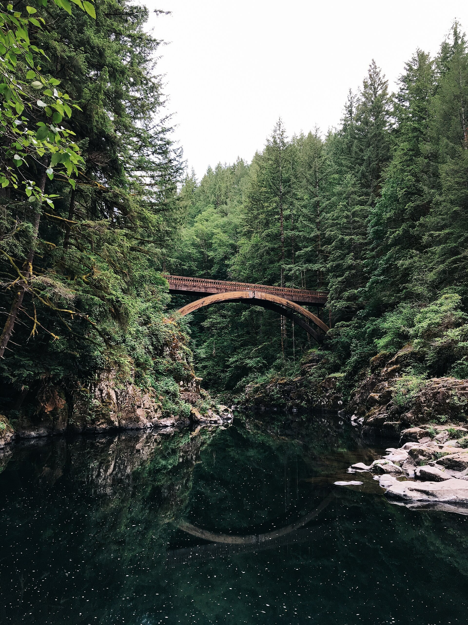
Moulton Falls Regional Park does not have one standard hiking route. It is a 387-acre Clark County park where a short visit to the falls and wooden arch bridge can turn into a longer walk on the Hantwick connector or the start of a much longer hike on Bells Mountain Trail. The right plan depends less on finding a single advertised distance and more on deciding how far beyond the developed park you want to go.
Park status checked September 2, 2026: The current Clark County park page lists the park and its facilities without a closure notice. A recreational fire ban remains in effect in unincorporated Clark County. This is a checked-date finding, not live trip status; reopen the official park page before leaving.
Which Moulton Falls Outing Fits Your Day?
| Choice | Best for | What defines it | Main planning issue |
|---|---|---|---|
| Short park visit | A short waterfall, bridge, picnic, or family stop | Stay near the developed park and river viewpoints | River edges and parking availability still require attention |
| Hantwick connector | A longer, gentler walk with a clear turnaround | Use the trail between Moulton Falls and the Hantwick Road trailhead | Official materials describe the Lucia connection differently; use the map and signs |
| Bells Mountain option | Experienced visitors prepared for a much larger outing | Treat Moulton Falls as access to a 7.5-mile trail, not as a short add-on | Distance, navigation, daylight, water, and the return plan all require more attention |
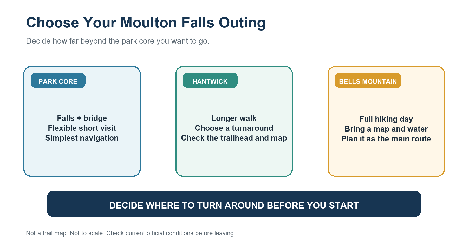
Choose a short park visit if the bridge, falls, forest, and a flexible turnaround are the goal. Choose the Hantwick option if the group wants a sustained walk without committing to a backcountry-style day. Bells Mountain belongs in a separate category: reaching its access point does not make the full trail a casual extension of the park visit.
Quick Facts for Moulton Falls Regional Park
| Detail | Current official planning value |
|---|---|
| Managing agency | Clark County Public Works, Parks and Lands |
| Address | 27781 NE Lucia Falls Road, Yacolt, Washington |
| Hours | 7 a.m. to dusk |
| Parking | 47 spaces plus 2 disabled parking stalls |
| Restroom | One restroom listed by the county |
| Park setting | 387 acres at the East Fork Lewis River and Big Tree Creek, with two waterfalls and an arch bridge |
| Hantwick connection | Current page: 2.5-mile trail; official map: 2.5 miles from Hantwick Road trailhead to Moulton Falls |
| Bells Mountain access | Current park page lists access to the 7.5-mile Bells Mountain Trail |
| Dogs | Allowed on leash; owners must clean up |
| Swimming | Allowed at Moulton Falls, but there are no lifeguards and users enter at their own risk |
The parking count is a facility total, not a promise that a space will be available. The restroom listing also does not guarantee that it will be open or serviced on a particular visit.
A Short Visit Around the Falls and Bridge
The simplest Moulton Falls plan is intentionally open-ended. Start with the developed park, the forested river setting, the waterfalls, and the wooden arch bridge. The county does not publish a single official mileage for a complete “park core loop,” so assigning one would create false precision. A short visit works best when the group agrees to turn around at the bridge, a viewpoint, or another signed point that leaves enough time to return before dusk.
This option has the lowest navigation burden, but it is not risk-free. Rock near the water can be wet or uneven, river levels change, and children need close supervision anywhere near the bank. The bridge is a viewpoint and crossing—not a jumping platform. Clark County explicitly prohibits diving or jumping from it.
The short option is also the easiest to adjust. If the parking area is full, the weather deteriorates, or current river conditions make the group uneasy, there is no need to force a longer route merely to meet a preset mileage target.
How the Hantwick Trail Connects the Parks
Clark County's current Moulton Falls page describes a 2.5-mile trail connecting the park to Lucia Falls Regional Park. The county's official trail map is more specific: it labels a 2.5-mile barrier-free trail from the Hantwick Road trailhead to Moulton Falls, then shows about one-eighth mile between Hantwick Road and Lucia Falls. The same map labels a separate 1-mile loop at Lucia Falls.
That distinction matters when estimating a turnaround. Do not assume that “2.5 miles to Lucia Falls” is a single signed segment beginning at the main Moulton Falls parking area. Open the official Lucia Falls and Moulton Falls trail map, identify which trailhead you are using, and follow the current signs on site.
For an out-and-back walk, set a time-based turnaround before starting. A path that feels gentle on the outbound leg still requires you to walk the same distance back. Groups with children, dogs, or limited daylight should factor the return into the plan rather than treating Hantwick as an automatic one-way finish.
When Bells Mountain Turns the Visit into a Full Hiking Day
The current county page lists access to the 7.5-mile Bells Mountain Trail. An older official map uses a 9-mile label, so the endpoint or measurement convention may have changed. Until a current route-specific source resolves that difference, this guide does not convert either number into a round trip or prescribe a complete Bells Mountain itinerary.
The practical rule is simpler: Bells Mountain is the gateway to a much longer hike, not a short add-on. Continue only if the group has a current map, enough daylight, water, navigation confidence, and a return plan that does not depend on improvising a ride. A visitor who came mainly for the falls and bridge should treat the Bells Mountain junction as a logical turnaround, not a challenge to keep going.
If a longer Southwest Washington hike is the goal, compare the options in Where to Hike Near Vancouver, Washington before choosing. That regional guide is better suited to comparing effort and scenery; this page stays focused on decisions inside Moulton Falls.
Parking, Hours, Dogs, and Facilities
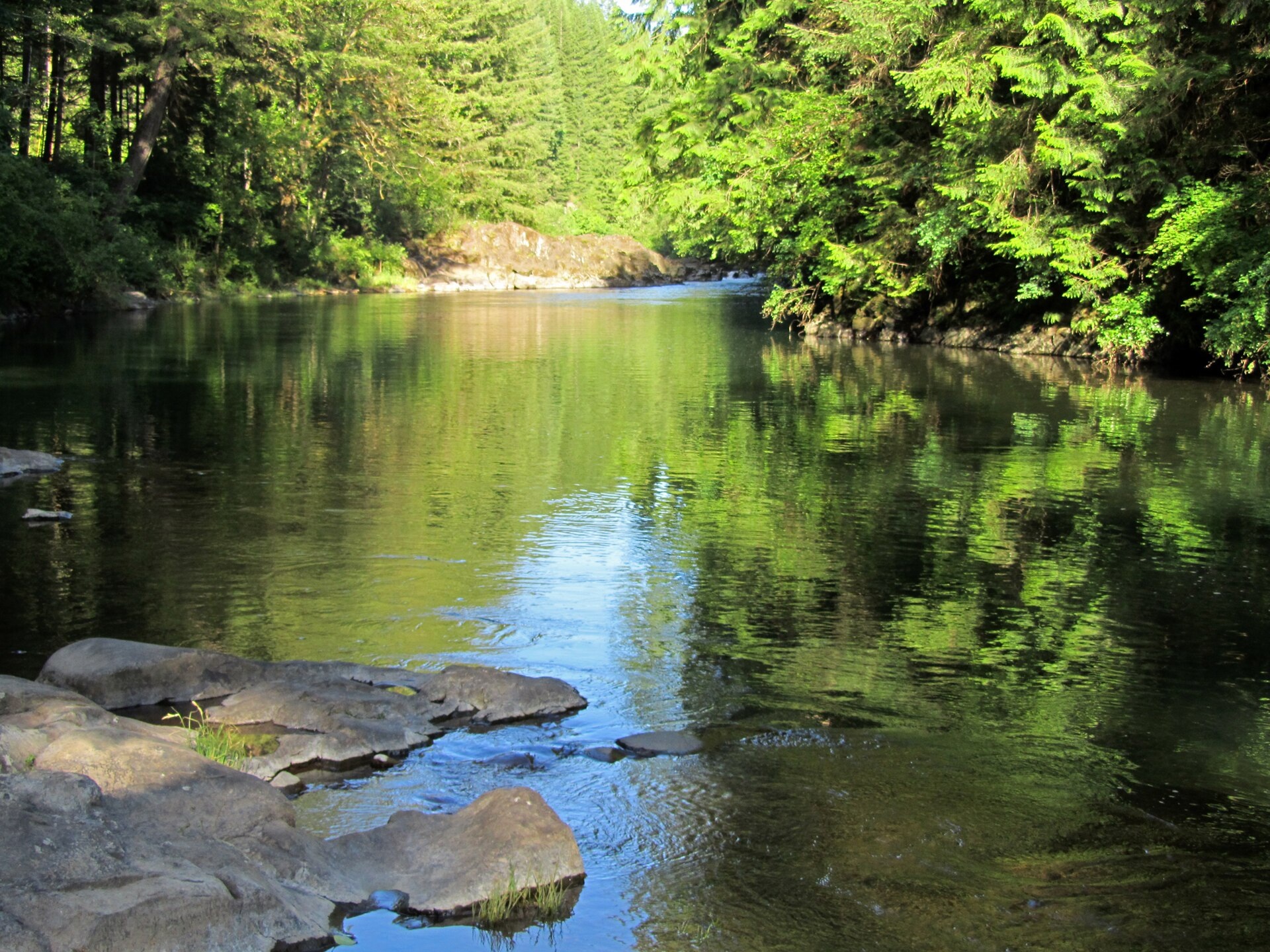
Moulton Falls is open from 7 a.m. to dusk. The county lists 47 parking spaces plus two disabled stalls, but the posted space count does not guarantee that a spot will be available. Do not park along a roadway or block access if the designated spaces are unavailable. Have a legal alternative in mind and leave rather than creating a roadside hazard.
Dogs are allowed in Clark County parks, but they must remain leashed unless a site is specifically designated off-leash; Moulton Falls is not listed as such an area. Owners must clean up after them. A leash is especially important around other visitors, riverbanks, bridges, and shared trail connections. The broader Columbia Gorge dog and leash guide explains how rules change among agencies.
The county lists one restroom. It does not list potable water on the current park page, so bring the water needed for the chosen outing—particularly if Bells Mountain is even a possibility. For pass and parking-system comparisons elsewhere in the region, use the Gorge parking, passes, and permits guide.
Swimming Risks in the East Fork Lewis River
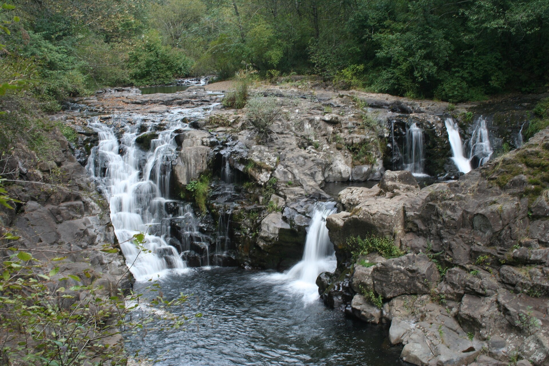
Swimming is allowed at Moulton Falls, but Clark County states that no lifeguards are on duty and that visitors enter at their own risk. The East Fork Lewis River can have swift currents and changing depths. Cold water can trigger involuntary gasping and loss of muscle control; sudden drop-offs, submerged debris, rocks, and unstable surfaces add hazards that may not be visible from shore.
Plan the hike so no one needs to enter the water. If someone chooses to swim, the county recommends a properly fitted life jacket, close supervision of children, swimming with a buddy, and avoiding fast-flowing water. Never dive from the bridge, a cliff, or a ledge. A calm-looking surface is not evidence that the current, depth, or underwater terrain is safe.
River conditions can change quickly, and a static article cannot show what they are like today. High water, storm debris, or flooding should keep you away from the water and may justify postponing the trip entirely. Check current county notices and the season, weather, and closure guide before departure.
When to Choose Another Hike
Choose another route if the main lot is unavailable, the group needs a precisely measured short loop, current high water makes the river corridor a poor fit, or the desired distance does not fit neatly between the Hantwick option and a true long hike. Nearby parks and Gorge trails offer clearer single-route objectives.
For a broader menu, start with hikes near Vancouver or hikes near Portland. Moulton Falls works best for groups that value flexibility: a scenic short stop can remain short, while a longer walk works only when you decide which trail to follow and where to turn around.
Related Guides
- Where to Hike Near Vancouver, Washington
- Best Hikes Near Portland
- Parking, Passes, and Permits in the Columbia River Gorge
- Dog and Leash Rules in the Columbia River Gorge
- Best Time to Hike the Columbia River Gorge
Official Sources
- Clark County: Moulton Falls Regional Park
- Clark County: Lucia Falls and Moulton Falls Trails map
- Clark County: Park Rules and FAQs
- Clark County: Swimming in County Parks
- Clark County: 2026 Recreational Burn Ban
- Clark County: Bridge and Trail Reopened
Photo and Graphic Credits
Tim Bogdanov — CC0 1.0 (32-moulton-falls-arch-bridge-over-water.jpg) | Jeff Hollett — CC BY-SA 4.0 (32-east-fork-lewis-river-at-moulton-falls.jpg)
PJ Blalock — Public domain (32-waterfall-and-forest-at-moulton-falls.jpg)
Graphic: original editorial synthesis; not a trail map and not to scale. Photos resized without cropping or color adjustment.