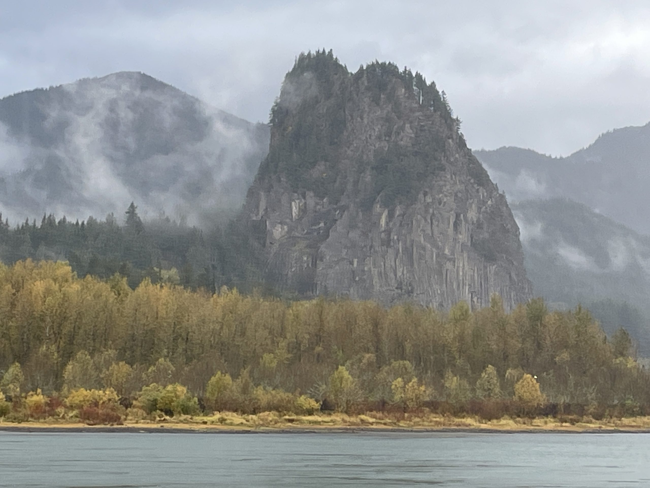
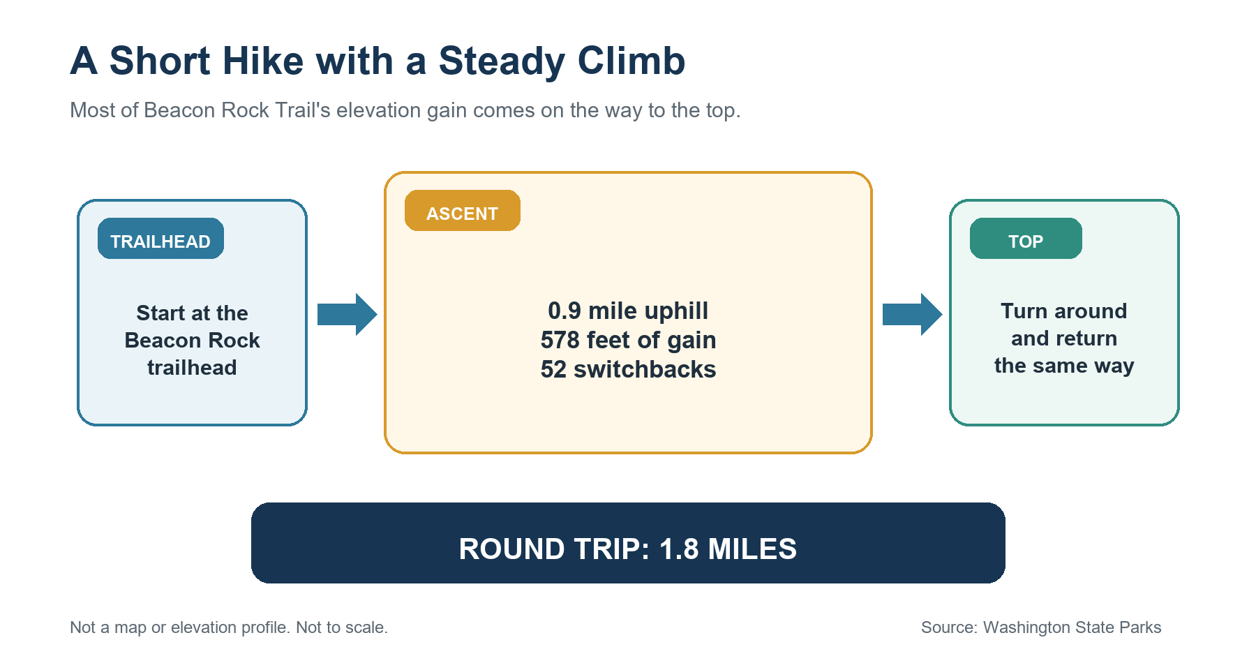
Beacon Rock Trail is short, but the climb is more demanding than the mileage suggests. The official route covers 1.8 miles round trip, gains 578 feet, and climbs the side of Beacon Rock through 52 switchbacks. That makes it a good choice when you want a clear summit objective without committing to a long day. Still, the mileage alone does not tell you whether the trail is a good fit for your group.
This guide helps you judge the climb before you go, then covers the route, parking, Discover Pass requirements, dogs, seasonal checks, and nearby alternatives.
Trail status checked September 1, 2026: Washington State Parks listed no hiking closure for Beacon Rock Trail. A Level 3 burn ban was in effect at Beacon Rock State Park, with no charcoal or wood fires allowed. Check the official park page and alerts again before leaving because restrictions and trail access can change.
Is the Beacon Rock Trail Right for You?
Beacon Rock works best for hikers who want a short outing with a clear objective and do not mind gaining elevation steadily. Its 1.8-mile round-trip distance leaves room in the day for another stop in the Columbia River Gorge, but the route packs 578 feet of climbing into the 0.9-mile ascent.
Washington State Parks labels the route easy to moderate. That agency rating is useful context, but it should not replace a personal assessment. Hikers who are comfortable with sustained uphill walking may find the route manageable. Those who choose it only because the mileage looks easy may be surprised by how much of the outing is spent climbing or descending.
The trail climbs directly along the side of Beacon Rock. People who are uncomfortable with heights, or who need a flat, explicitly accessible route, should consider a different walk. The official park information does not identify Beacon Rock Trail itself as wheelchair- or stroller-accessible.
Why This 1.8-Mile Hike Feels Steeper Than It Looks
The simplest way to understand the effort is to look at the distance and elevation together:
- 0.9 mile from the trailhead to the upper end of the route;
- 578 feet of elevation gain;
- 52 switchbacks on the ascent;
- the same 0.9-mile route for the descent.
The switchbacks spread the climb across the rock, but they do not remove it. The return is downhill, yet it still requires attention and control rather than an easy walk back to the parking area.
When Another Nearby Trail May Work Better
Choose another route if you want a longer hike, a flatter surface, or a walk that does not climb along the side of a prominent rock formation. Hamilton Mountain is the better comparison for a longer Gorge hike with waterfall, summit, and loop choices. Doetsch Walking Path is the clearer state-park alternative when a paved, flat loop is the priority.
For a wider set of options, use the guides to hikes near Vancouver, Washington and the best hikes in the Columbia River Gorge.
Beacon Rock Trail at a Glance
| Detail | Official planning value |
|---|---|
| Distance | 1.8 miles round trip |
| Elevation gain | 578 feet |
| Route type | Out and back |
| Official difficulty | Easy to moderate |
| Switchbacks | 52 |
| Trail use | Hiking only |
| Park hours | 8:00 a.m. to dusk, year-round |
| Parking pass | Discover Pass required unless an official exemption applies |
| Dogs | Allowed on a leash no longer than 8 feet and under physical control |
| Managing agency | Washington State Parks |
The park brochure lists Beacon Rock Trail as 0.9 mile, while the official trailhead sheet describes the hike as 1.8 miles out and back. Those figures use different conventions: 0.9 mile for the one-way trail and 1.8 miles for the complete trip.
What to Expect on the Climb
Beacon Rock Trail begins at its designated trailhead inside Beacon Rock State Park. It is a hiker-only route rather than one of the park's multiuse trails. Official trail hours are 8:00 a.m. to dusk.
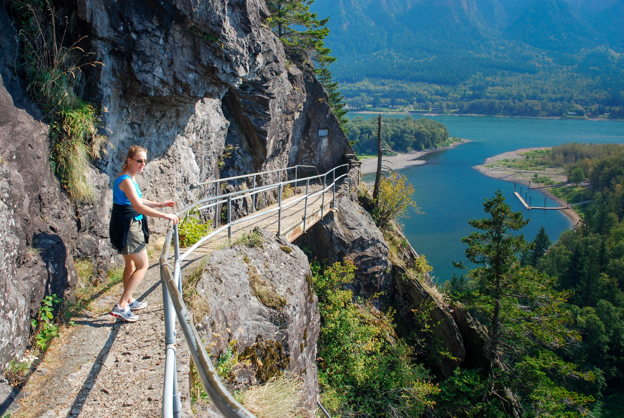
The route's defining feature is its series of 52 switchbacks. They carry the trail up the side of the rock while opening views over the Columbia River Gorge. The repeated turns make the ascent more gradual than a direct climb would be, but hikers still gain 578 feet before reaching the top of the route.
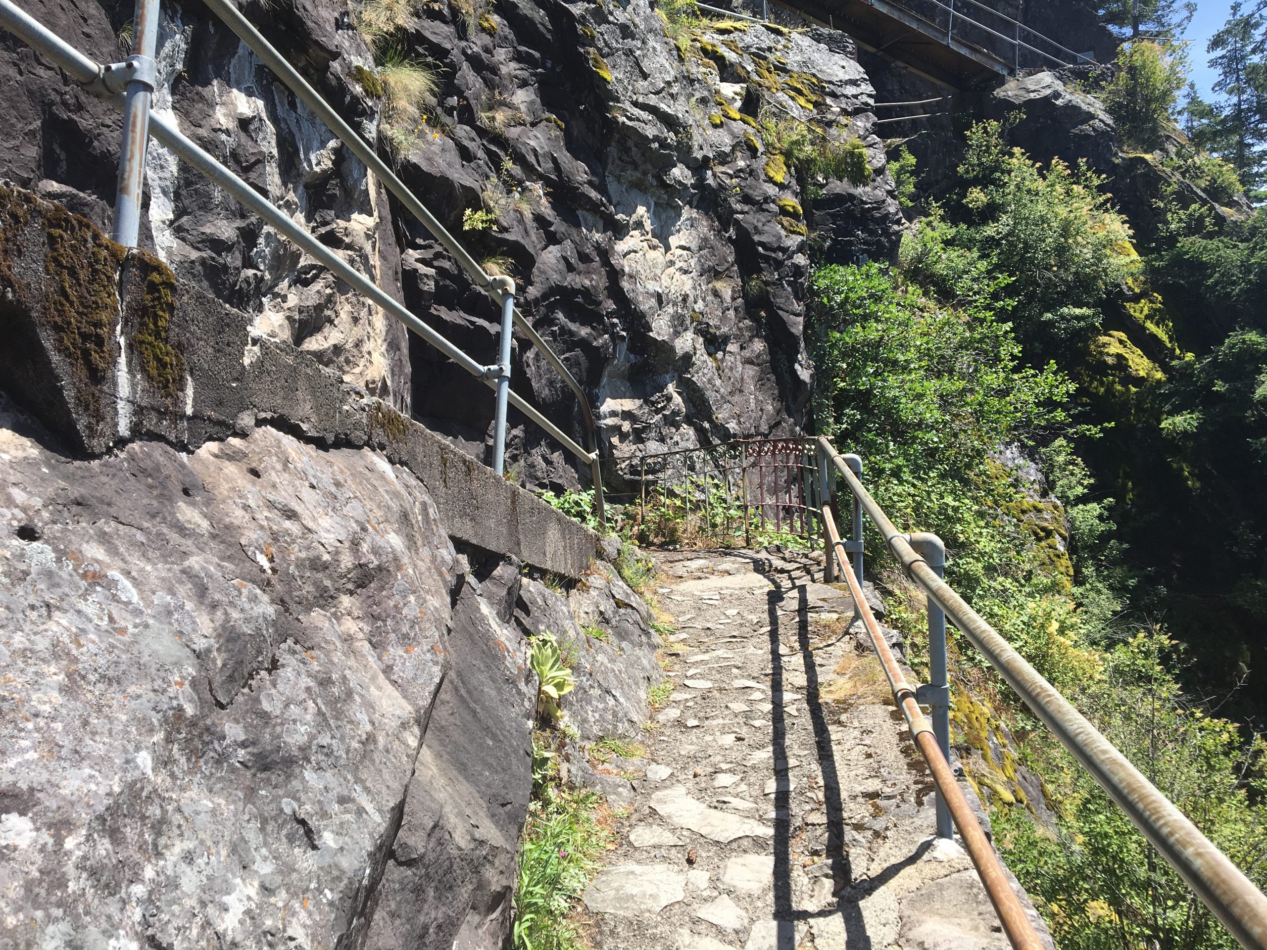
Washington State Parks did not provide current details about individual railings, stairs, bridges, or surface conditions in the sources used for this guide. Check the latest park alerts for temporary damage, construction, or closures. Stay on the designated trail and follow every posted restriction.
At the top, the route ends rather than continuing into a longer loop. Return by the same switchbacks to the trailhead. That simple out-and-back format makes navigation straightforward, but it also means everyone descends the same steep, winding route they climbed.
Parking and Discover Pass Requirements
Beacon Rock State Park is at 34841 State Route 14 in Skamania, Washington. A Discover Pass must be displayed when parking at Washington State Parks unless you qualify for an official exemption.
As checked September 1, 2026, the base prices were:
- $45 for an annual Discover Pass;
- $10 for a one-day Discover Pass.
Transaction or dealer fees may apply through some purchase channels. Washington State Parks lists an automated pay station among the park's amenities, but arrive with a valid pass or confirm how you will buy one instead of relying on a particular machine.
The official sources reviewed for this guide did not confirm the number of spaces at the Beacon Rock Trailhead or guarantee parking availability at any particular time. Do not park outside designated areas or treat the shoulder of State Route 14 as an alternative.
For a comparison of Gorge access systems, see parking, passes, and permits in the Columbia River Gorge.
Bringing a Dog or Hiking with Children
Dogs are allowed at Beacon Rock State Park, but Washington State Parks requires pets to remain under physical control on a leash no longer than 8 feet. Owners must also clean up after their animals. On a switchback route, a short, controlled leash helps keep the dog close when other hikers are passing.
When deciding whether to bring children, focus on the specific route facts rather than a broad difficulty label: 1.8 miles round trip, 578 feet of climbing, 52 switchbacks, and a trail built along the rock. Consider whether each person can manage both the climb and the descent along the same route while following directions near other trail users.
No single age cutoff can determine whether the hike is appropriate. The official information reviewed for this guide also does not identify Beacon Rock Trail as stroller- or wheelchair-accessible. Families needing a confirmed flat route should compare the Doetsch Walking Path instead.
The broader Columbia River Gorge dog and leash guide explains how rules change across land managers.
Weather, Seasonal Conditions, and Current Alerts
Beacon Rock's day-use area is listed as open in the current Washington State Parks winter schedule, although parts of the park's campground have seasonal operating dates. Day-use status does not guarantee that the trail will be free of ice, storm damage, smoke, or a temporary closure.
Before the hike, check three separate things:
- Park alerts: Look for a notice that specifically affects Beacon Rock Trail or its trailhead.
- Weather and air quality: Rain, freezing conditions, heat, smoke, and strong wind can change whether the climb makes sense for your group.
- Park-wide restrictions: A burn ban controls fires and cooking equipment; it does not automatically mean the hiking trail is closed.
On September 1, 2026, Beacon Rock State Park was under a Level 3 burn ban. Gas or propane self-contained camping stoves and portable gas or propane fire pits were allowed where otherwise permitted, but charcoal and wood fires were not. The park also carried a technical-climbing notice. That climbing notice applied to climbing faces, not the Beacon Rock hiking trail.
Use the Columbia River Gorge seasons, weather, and closures guide for broader trip timing, but rely on Washington State Parks for the current route status.
Beacon Rock vs. Nearby Alternatives
Beacon Rock is the most focused choice when you want a short summit objective and are comfortable with a steady climb. Two nearby state-park options serve different needs.
Choose Hamilton Mountain for a Longer Hike
Hamilton Mountain Trail is the better choice when you want a more substantial outing and need to choose among waterfalls, the summit, or a full loop. It should not be treated as an extension of Beacon Rock Trail; the routes start from different trailheads and solve different trip-planning needs.
Choose Doetsch Walking Path for a Flatter Walk
Washington State Parks describes Doetsch Walking Path as a paved, flat 1.2-mile loop. It is the clearer alternative when low climbing and an easier walking surface matter more than reaching the top of Beacon Rock. Check the current park page before visiting because access and facilities can change.
Related Guides
- Where to hike near Vancouver, Washington
- Best hikes in the Columbia River Gorge
- Hamilton Mountain Trail
- Columbia River Gorge parking, passes, and permits
- Dog and leash rules in the Columbia River Gorge
- Best time to hike the Columbia River Gorge
Official Sources
- Beacon Rock State Park — Washington State Parks
- Washington State Parks alerts
- Beacon Rock State Park: River to Rock Trailhead map and route sheet
- Beacon Rock State Park brochure and map
- Washington State Parks rules and regulations
- Discover Pass purchase information
- Other ways to buy a Discover Pass
- Washington State Parks winter schedule
Photo and Graphic Credits
- Beacon Rock overview — Broken8weight — CC BY-SA 4.0; resized for layout without cropping or color adjustment.
- Rock-cut trail and railings — Kingofthedead — CC BY-SA 4.0; resized for layout without cropping or color adjustment.
- Hiker and river view — Gary Halvorson, Oregon State Archives — CC BY 4.0; resized for layout without cropping or color adjustment.
- Functional graphic — Original editorial synthesis based on Washington State Parks route data; not a map or elevation profile and not to scale.