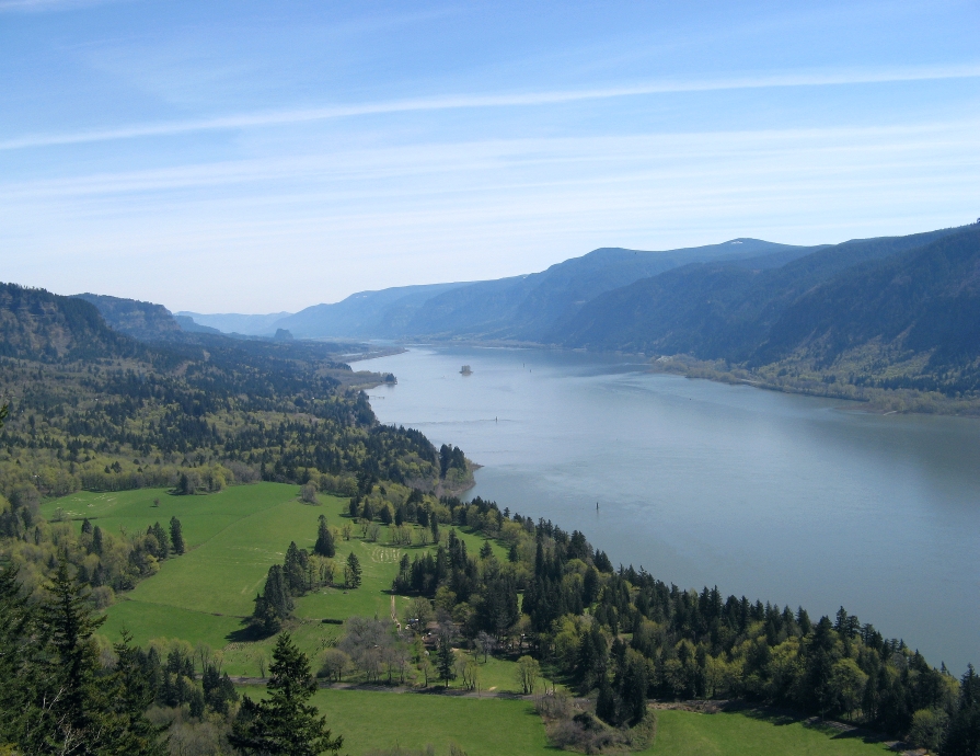
Compare the practical differences among 17 established route guides, narrow the list by time, effort, terrain, scenery, and access, then open the full guide before you go.
Static route-selection guide · Shared alerts and access information checked September 1, 2026 · Recheck official sources before every trip
CURRENT STATUS CHECK The Forest Service destination index listed Tamanawas Falls Trailhead as open on September 1, 2026, and no Tamanawas closure appeared in the current Mt. Hood alert list reviewed that day. Fire restrictions were in effect in both the Columbia River Gorge National Scenic Area and Mt. Hood National Forest. These are dated checks, not guarantees; open the current agency alert before publication and travel.
Use this guide to build a short list
This page puts the same practical details side by side for all 17 hikes, helping you build a short list before opening the available route guides and official sources.
Start with the time and energy you actually have. Even a famous trail may be a poor fit if the drive, parking, climb, terrain, or seasonal access leaves too little room for delays. The comparison below focuses on the differences that can shape your day instead of naming one hike as the best for everyone.
This guide does not provide live conditions or personalized safety advice. Distances, route options, and access requirements can change, and a route that looks manageable on paper may feel very different in heat, wind, snow, or wet weather.
Start with how much time you have
Plan for the entire outing, not just the mileage listed on a trail page. Allow time for the drive or transit trip, finding legal parking, completing the hike, and changing plans if the day takes longer than expected.
For a short waterfall outing
Start with routes that offer a clear short option: the Multnomah Falls viewpoint area, Latourell Falls, Horsetail and Ponytail Falls, Fairy Falls, or Wahclella Falls. These outings still vary in climbing, footing, parking, and crowds, so a short hike is not necessarily an effortless one.
For a half-day hike
Dry Creek Falls, Angel’s Rest, Mirror Lake, and several Eagle Creek turnarounds are good places to start. Your choice may come down to the amount of climbing, exposed trail, snow, the turnaround you choose, or the time required to reach the trailhead.
For a longer or more demanding day
Dog Mountain, Hamilton Mountain, Cape Horn, Tom Dick and Harry Mountain, and Ramona Falls generally require more time and effort. Longer versions of Larch Mountain and Trillium Lake can also fill most of a day, depending on the starting point and season. Check the full route guide before deciding whether any of these hikes fit your schedule.
Compare the 17 routes
The tables highlight why you might consider each route and what you should check before making plans. Use them as a starting point, then read the full guide and review current alerts from the managing agency.
Oregon side of the Columbia River Gorge
| Route | Why you might choose it | What to check first |
|---|---|---|
| Multnomah Falls | A landmark waterfall with options ranging from a brief viewing stop to a longer climb. | The route option, parking location and 2026 timed-use rules depend on how and when you arrive. |
| Eagle Creek | Canyon waterfalls with several turnaround options. | Narrow ledges and exposed sections can matter more than the mileage alone. |
| Angel's Rest | A steady climb ending in broad Columbia River views. | Wind, heat, ice and exposed edges can make the same route feel very different. |
| Wahclella Falls | A compact canyon hike with a rewarding waterfall at the end. | The small parking area, day-use fee and consistently damp footing deserve an advance check. |
| Latourell Falls | A signed loop connecting lower and upper waterfalls. | Parking rules, slick rock and the loop’s climbing are more important than the short mileage suggests. |
| Dry Creek Falls | A moderate forest hike to a waterfall from Cascade Locks. | The parking operator and trail manager are different, so check both access and trail information. |
| Larch Mountain | Either a short summit viewpoint or a much longer forest approach. | Choose the exact version first and confirm that the seasonal summit road is open. |
| Horsetail and Ponytail Falls | A roadside waterfall with the option to add a short, steeper hike. | Do not assume historic loop connections are open; check the specific segment you plan to use. |
| Fairy Falls | A shorter waterfall hike with a steady climb from Wahkeena Falls. | Parking and every connection matter if you plan to extend the outing into a longer loop. |
Washington side of the Columbia River Gorge
| Route | Why you might choose it | What to check first |
|---|---|---|
| Dog Mountain | A strenuous climb with open views and spring wildflowers. | The seasonal vehicle reservation and the year-round recreation fee are separate requirements. |
| Hamilton Mountain | Waterfall, viewpoint, and loop options from one trailhead. | Bring a realistic turnaround plan and confirm the Discover Pass requirement. |
| Cape Horn | A longer hike with Gorge views and an upper-route option. | The lower loop closes seasonally from February 1 through July 15; check current notices before using it. |
Mount Hood
| Route | Why you might choose it | What to check first |
|---|---|---|
| Tamanawas Falls | A shaded waterfall hike on the east side of Mount Hood. | Confirm the current trailhead, bridge, fire, and winter-condition notices before relying on the route. |
| Mirror Lake | A mountain lake with the option to continue higher. | Summer recreation fees and winter Sno-Park rules apply through different systems. |
| Tom Dick and Harry Mountain | A longer ridge outing beyond Mirror Lake. | The extension is steeper and rockier, and snow can turn it into a different trip. |
| Ramona Falls | A longer waterfall hike in a distinctive Mount Hood setting. | The Sandy River crossing is unbridged; turn around if a safe crossing is not obvious. |
| Trillium Lake | An easier summer lake loop or a longer winter outing. | Gate position, starting point and Sno-Park rules change the route by season. |
A short hike can still have a serious tradeoff
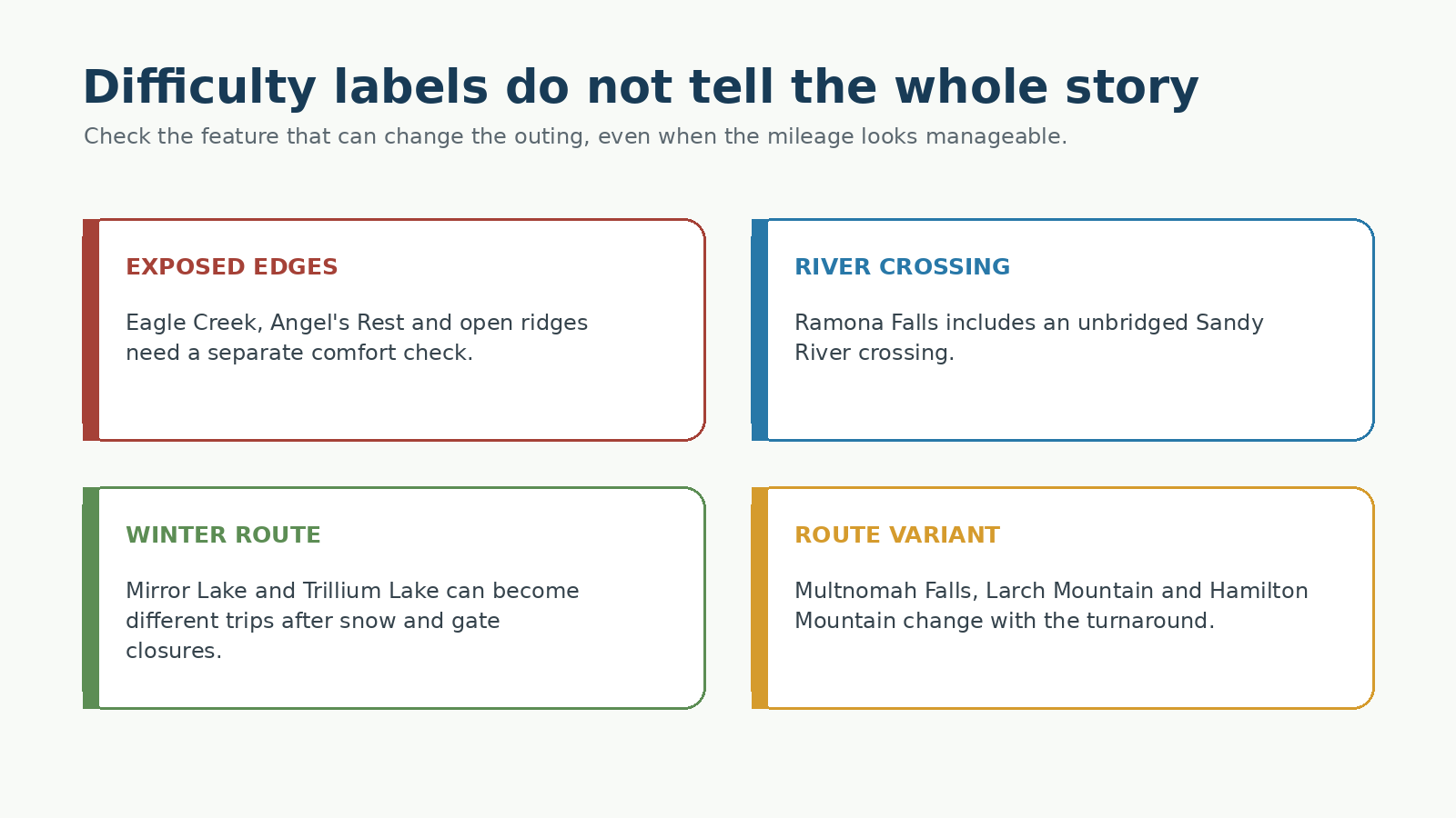
Distance and elevation gain are useful, but they do not describe every feature that changes comfort, timing or consequences. Keep the following questions separate from a general easy/moderate/difficult label:
- Are there narrow ledges or exposed edges that someone in the group does not want?
- Does the route require an unbridged river crossing?
- Will snow or ice make route-finding and footing substantially different?
- Does the guide include several turnarounds with very different mileage and climbing?
- Could wind, heat, smoke, or wet rock mean turning around earlier than planned?
For example, Eagle Creek’s exposed tread, the river crossing at Ramona Falls, and winter travel around Mirror Lake present very different challenges. A single difficulty score would hide the distinctions that matter most when planning a hike.
Parking and permits may decide which hike works
Two hikes may look equally appealing until you compare parking, permits, road access, and shuttle schedules. Check each system separately before settling on a route.
- Multnomah Falls: The I-84 timed-use permit is required during the 2026 dates and hours listed on Recreation.gov, but it does not guarantee parking.
- Dog Mountain: The spring vehicle reservation and trailhead recreation fee are separate requirements, and the shuttle has its own operating schedule.
- Hamilton Mountain: Parking at Beacon Rock State Park requires a Washington Discover Pass.
- Mirror Lake and Trillium Lake: Summer parking fees and winter Sno-Park rules use separate systems.
- Oregon State Parks: Day-use parking fees changed in 2026, and federal recreation passes do not cover Oregon State Parks parking.
If access will determine your choice, read the site’s parking and permit guide or car-free hiking guide rather than relying on a brief table entry.
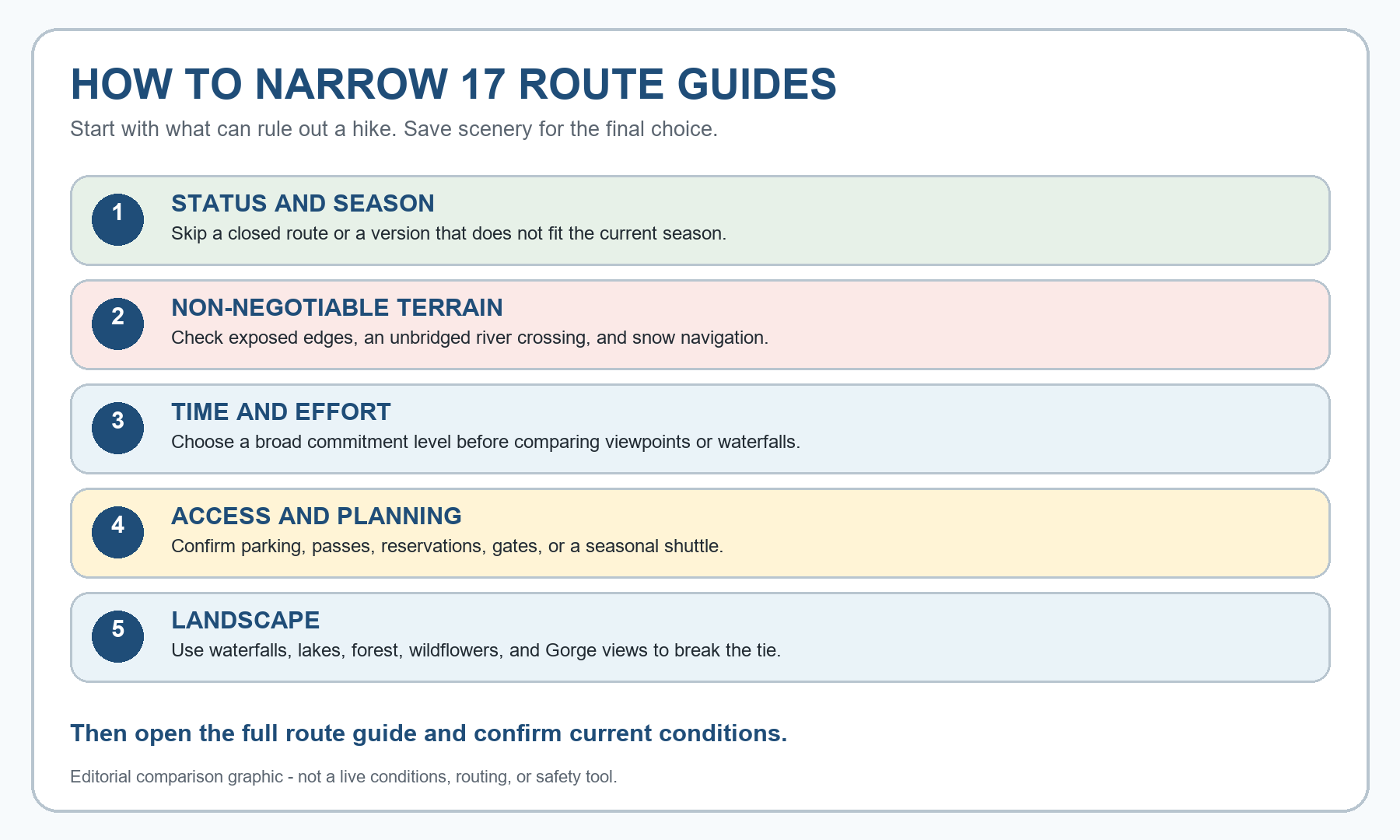
How to narrow the list
- Check current status and season first. Rule out an official closure, an unavailable route version, or conditions that require skills and equipment your group does not have.
- Set a realistic time and effort limit. Include travel, legal parking or transit, the hike itself, and a buffer for delays.
- Choose the specific route version. A viewpoint visit, a short turnaround, a summit extension, and a winter starting point can lead to very different outings.
- Rule out terrain your group would rather avoid. Consider exposed edges, river crossings, snow travel, steep footing, and route-finding separately.
- Compare access and planning requirements, then use scenery to break the tie. Read the full route guide and the managing agency’s latest alert before finalizing your plans.
What this guide can and cannot tell you
This guide can help you decide which routes deserve a closer look by placing the same key details side by side. It also shows where route options, exposed terrain, river crossings, permits, or seasonal access may affect your plans.
It cannot measure your fitness, decide whether a trail is safe for a particular child or dog, guarantee parking, predict current footing, or replace checks for weather, fire, smoke, road conditions, and closures. When information is unavailable or inconsistent, the full route guide should say so rather than treating missing information as a reason to recommend a route.
Frequently asked questions
Will this guide choose a hike for me?
No. It helps you compare the same practical details across 17 routes. You decide which hikes belong on your short list, then read the full guides and check the relevant official sources.
Why do route statuses have a checked date?
Closures, road access, fire restrictions, fees, and seasonal rules can change after this page is updated. A checked date tells you when the shared sources were reviewed; it is not a guarantee that the same conditions still apply.
Are the routes ranked from best to worst?
No. The right choice depends on your schedule, the route option, the terrain your group prefers, and current access. This guide compares practical details without assigning an overall score.
Why are exact hiking times not listed for every route?
Route options, pace, footing, and conditions can make a single time estimate misleading. Treat the range in each route guide as a planning estimate, not a guaranteed finish time.
Can I use this page instead of checking official alerts?
No. Closures, road access, fees, permits, and seasonal rules can change after this page is updated. Check the relevant agency source again before you leave.
What should I do after narrowing the list?
Open the full route guide, choose the exact route option, and review the managing agency’s current alerts, access information, and permit requirements before you leave.
Related planning guides
- Best Hikes Near Portland
- Best Hikes in the Columbia River Gorge
- Best Hikes on Mount Hood
- Best Hikes Near Vancouver, Washington
- Columbia River Gorge parking, passes and permits
- How to hike the Columbia River Gorge without a car
- Dog and leash rules in the Columbia River Gorge
- Columbia River Gorge hiking seasons, weather and closures
Official Sources
Key access information was checked on September 1, 2026. Route details also come from the dedicated guides and the managing-agency sources cited in them. Check the relevant source again before publication or travel.
- USDA Forest Service – Columbia River Gorge alerts
- USDA Forest Service – Mt. Hood National Forest alerts
- USDA Forest Service – Tamanawas Falls Trailhead
- Oregon State Parks – day-use parking permits
- USDA Forest Service – Columbia River Gorge passes
- Recreation.gov – Multnomah Falls I-84 timed-use permit
- Recreation.gov – Dog Mountain Trail System permits
- Washington State Parks – Discover Pass
- Oregon Department of Transportation – TripCheck
- Oregon Department of Transportation – Sno-Park program
- AirNow – Fire and Smoke Map
Photo and Graphic Credits
- Cape Horn view – etliebe; public domain; resized for layout.
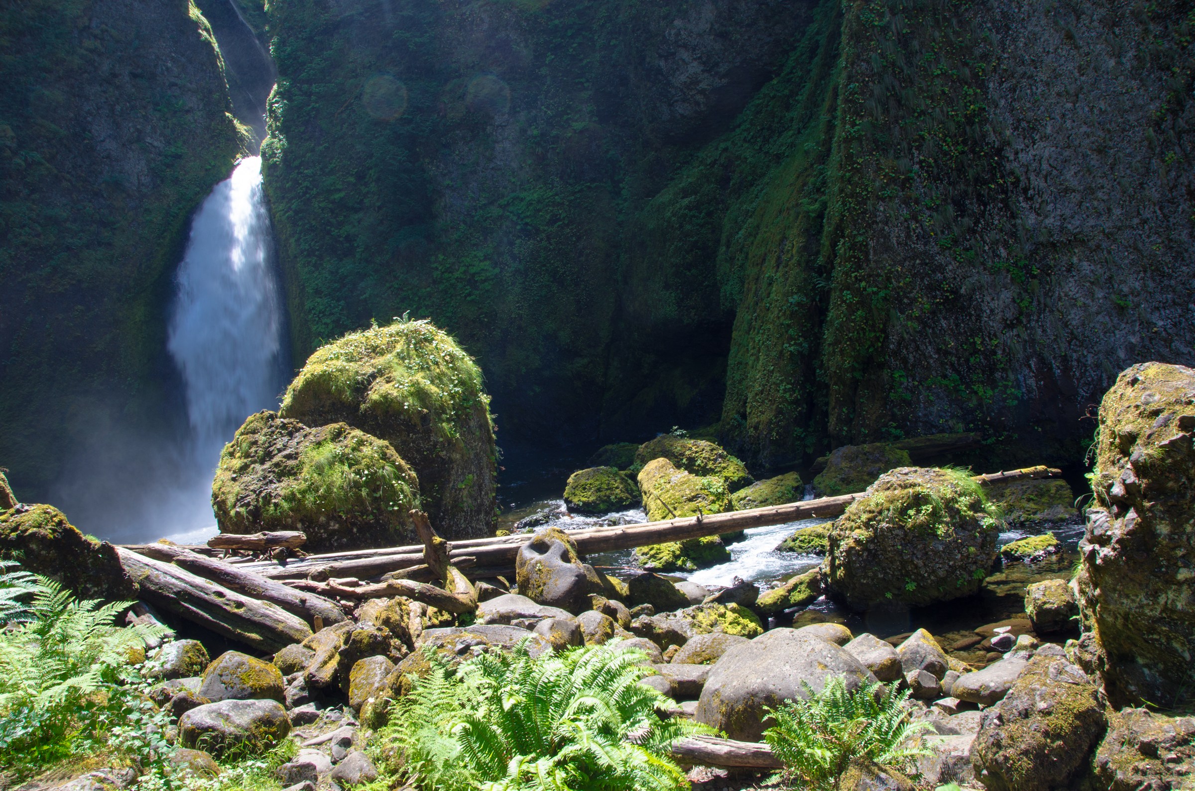
- Wahclella Falls and boulders – U.S. Forest Service Pacific Northwest Region; public domain; resized for layout.
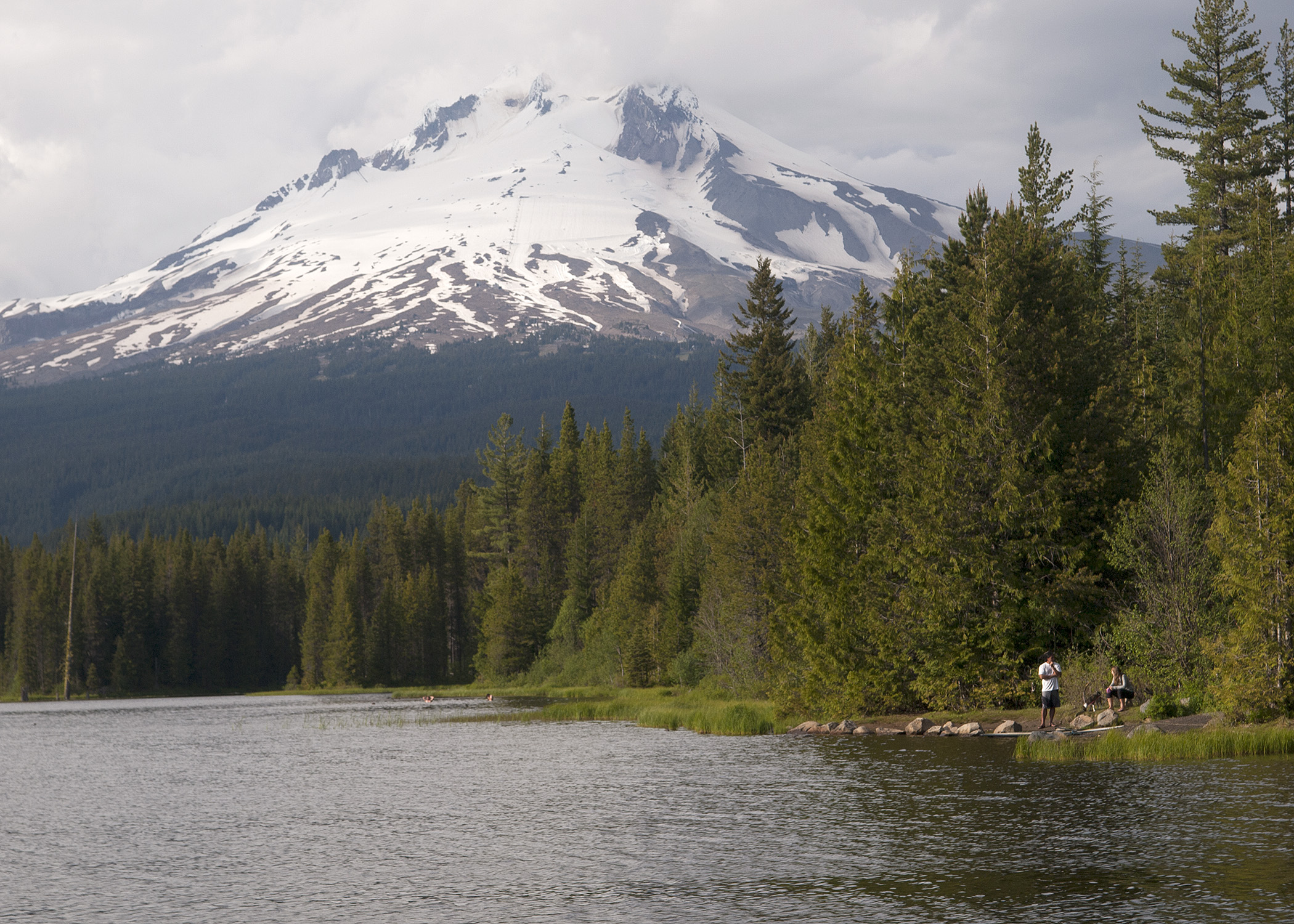
- Trillium Lake and Mount Hood – Oregon Department of Fish and Wildlife; CC BY-SA 2.0; resized for layout.
- CC BY-SA 2.0 license – License for the Trillium Lake photograph.
The route-choice sequence and terrain-risk comparison graphics were created for this article. They are editorial comparison graphics, not official maps, elevation profiles, live conditions feeds, or safety ratings.