Fairy Falls from Wahkeena: A Short, Steep Waterfall Hike in the Gorge
Fairy Falls sits 1.1 miles up Wahkeena Trail #420. Here is what to expect on the climb, where to park, and why the falls make a practical turnaround when longer trail connections are uncertain.
Research-based guide · Official information checked August 27, 2026 · Based on official sources rather than firsthand trail testing
TRAIL UPDATE — Fairy Falls is reached from the Wahkeena Falls Day Use Area on Trail #420. Check the day-use area, Wahkeena Trail, and any Multnomah-Wahkeena loop connections on the current Forest Service alerts page before you go.
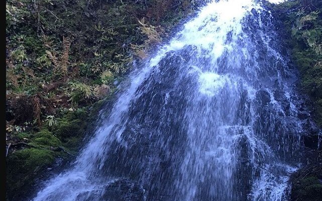
Fairy Falls spreads across mossy rock about 1.1 miles up the Wahkeena Trail. Photo: Forest Service Pacific Northwest Region · Public domain · source
Fairy Falls starts at the Wahkeena Falls trailhead
According to Travel Oregon, Fairy Falls is 1.1 miles up Wahkeena Trail #420 from the Wahkeena Falls Day Use Area. The 20- to 30-foot fan waterfall sits beside Wahkeena Creek and can only be reached on foot.
The basic out-and-back is about 2.2 miles round trip. The steady climb from the Historic Highway makes the hike more demanding than the distance may suggest, especially when the trail is wet, rocky, or slippery. Because Fairy Falls has no separate trailhead, navigation should begin at Wahkeena Falls.
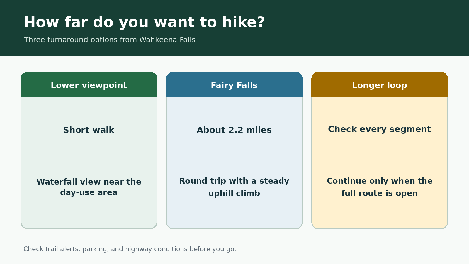
Route comparison created for this guide; not an official map or GPS route.
At a glance
|
Where to turn around |
Approximate distance |
What to expect |
Best for |
|---|---|---|---|
|
Lower Wahkeena viewpoint |
Short walk from the day-use area |
Little climbing |
A quick waterfall stop |
|
Fairy Falls |
About 2.2 miles round trip |
Steady climb; wet and rocky sections |
A focused half-day hike |
|
Longer Wahkeena-Multnomah loop |
Longer than the Fairy Falls out-and-back |
More junctions and exposed sections |
After confirming every trail connection is open |
Distances can vary with current closures and route choices. Check the latest Forest Service map and alerts before you go.
The lower Wahkeena Falls viewpoint
Wahkeena Falls is visible near the day-use area, so the lower viewpoint is a good option when you have limited time or when weather and footwear make the climb unsuitable. Watch for traffic when crossing the Historic Highway or walking between the parking area and trail facilities.
Before starting uphill, check that Trail #420 is open and pay attention to the trail surface. Waterfall spray, leaf litter, and winter ice can make the footing slippery within a short distance.
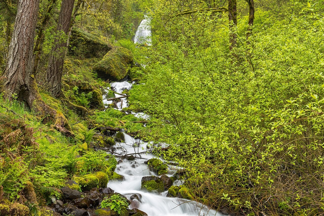
Wahkeena Creek keeps parts of the trail damp even when the rest of the Gorge is dry. Photo: Gary Halvorson, Oregon State Archives · CC BY 4.0 · source · license
The hike from Wahkeena Falls to Fairy Falls
The trail climbs through a series of switchbacks and passes viewpoints above the lower waterfall. Narrow sections, wet rock, and steady elevation gain can make the route feel more demanding than its mileage suggests. Take your time on the descent, when slippery stone and tired legs can make footing less secure.
Fairy Falls spreads across mossy rock in a delicate fan. Stay in the established viewing area, leave room for other hikers, and avoid climbing beside the cascade. The ground around the falls often remains damp even when other parts of the Gorge are dry.
Why Fairy Falls makes a good turnaround
For many hikers, Fairy Falls is a natural turnaround. It provides a clear destination without committing to the much longer Multnomah-Wahkeena loop, and returning the same way avoids relying on additional trail connections.
Trails beyond Fairy Falls connect with a larger network, but an older loop description does not confirm that the full route is open today. Check every trail segment before leaving the day-use area. If any connection is closed or unclear, turn around at Fairy Falls and return to Wahkeena.
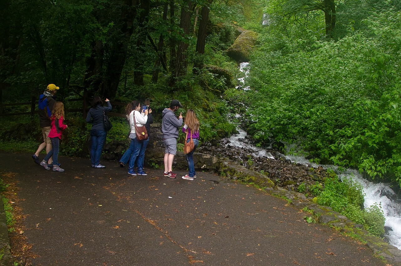
The lower Wahkeena Falls viewpoint is an easy alternative when rain or trail conditions make the climb unsuitable. Photo: U.S. Forest Service Pacific Northwest Region · Public domain · source
Parking at Wahkeena Falls and Historic Highway access
Wahkeena Falls has a small parking area that is separate from the I-84 Multnomah Falls entrance. Do not assume that a reservation or permit for one access point applies to another. Check the current Forest Service page for 2026 parking and access rules before you go.
If the lot is full, do not park on the roadside or walk along an unsafe highway shoulder. Come back later or choose another waterfall rather than adding to congestion along the Historic Highway.
When to turn around early
Turn around if you encounter ice, strong wind, falling debris, smoke, a blocked trail, or an official closure. Heavy rain can make the waterfalls more impressive while also making the trail especially slick. In hot weather, the shaded canyon may feel cool even when exposed sections near the highway are much warmer.
Nearby waterfall alternatives
For the shortest visit, stop at the lower Wahkeena Falls viewpoint. Horsetail and Ponytail Falls offer another short waterfall hike, while Wahclella Falls follows a longer canyon route. See the Gorge waterfall guide for more options organized by trip style.
Official sources
Last checked August 27, 2026. Trail access and highway conditions can change, so review current alerts before your trip.
Travel Oregon — Wahkeena Falls
USDA Forest Service — Columbia River Gorge alerts
USDA Forest Service — Hiking Loops Near Multnomah Falls distance chart
Photo and graphic credits
20181205 CRGNSA Fairy Falls by Alexa Pengelly – 1 — Forest Service Pacific Northwest Region; Public domain. Source
Wahkeena Falls, Historic Columbia River Highway, Columbia River Gorge – DPLA – 3a0af2a4290d56e3e479e0c7eeb97435.jpg — Gary Halvorson, Oregon State Archives; CC BY 4.0. Source · License
Family at Old Wahkeena Falls Viewing Area 2-Columbia River Gorge (24760504319).jpg — U.S. Forest Service- Pacific Northwest Region; Public domain. Source
Route comparison graphic created for this guide; not an official map, GPS track, or elevation profile.