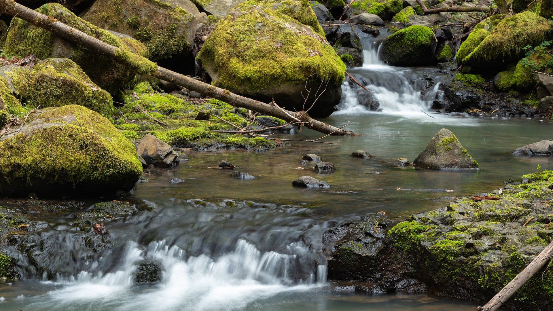
The hike from Lower Macleay to Pittock Mansion offers one of Portland’s clearest transitions from city streets to forest. It begins beside Balch Creek, passes the Stone House, climbs the Wildwood Trail, crosses NW Cornell at a marked crosswalk, and finishes at a viewpoint above the city. Although the trail is easy to reach from Portland, it is not a flat stroll: the full round trip is about five miles with roughly 1,130 feet of climbing on the way up.
Before you start, decide whether your goal is the Stone House, the full climb to Pittock Mansion, or simply the mansion grounds and viewpoint. These are three distinctly different outings, even though search results often group them together.
Route restriction rechecked September 24, 2026. No closure specific to the Lower Macleay–Pittock corridor appeared on Portland Parks & Recreation’s closure page during this check. Conditions can change after wind, heavy rain, high water, or maintenance work. Recheck the current closure page and the Forest Park map before leaving. The free Forest & Washington Park Express Shuttle was a summer 2026 pilot and has ended.
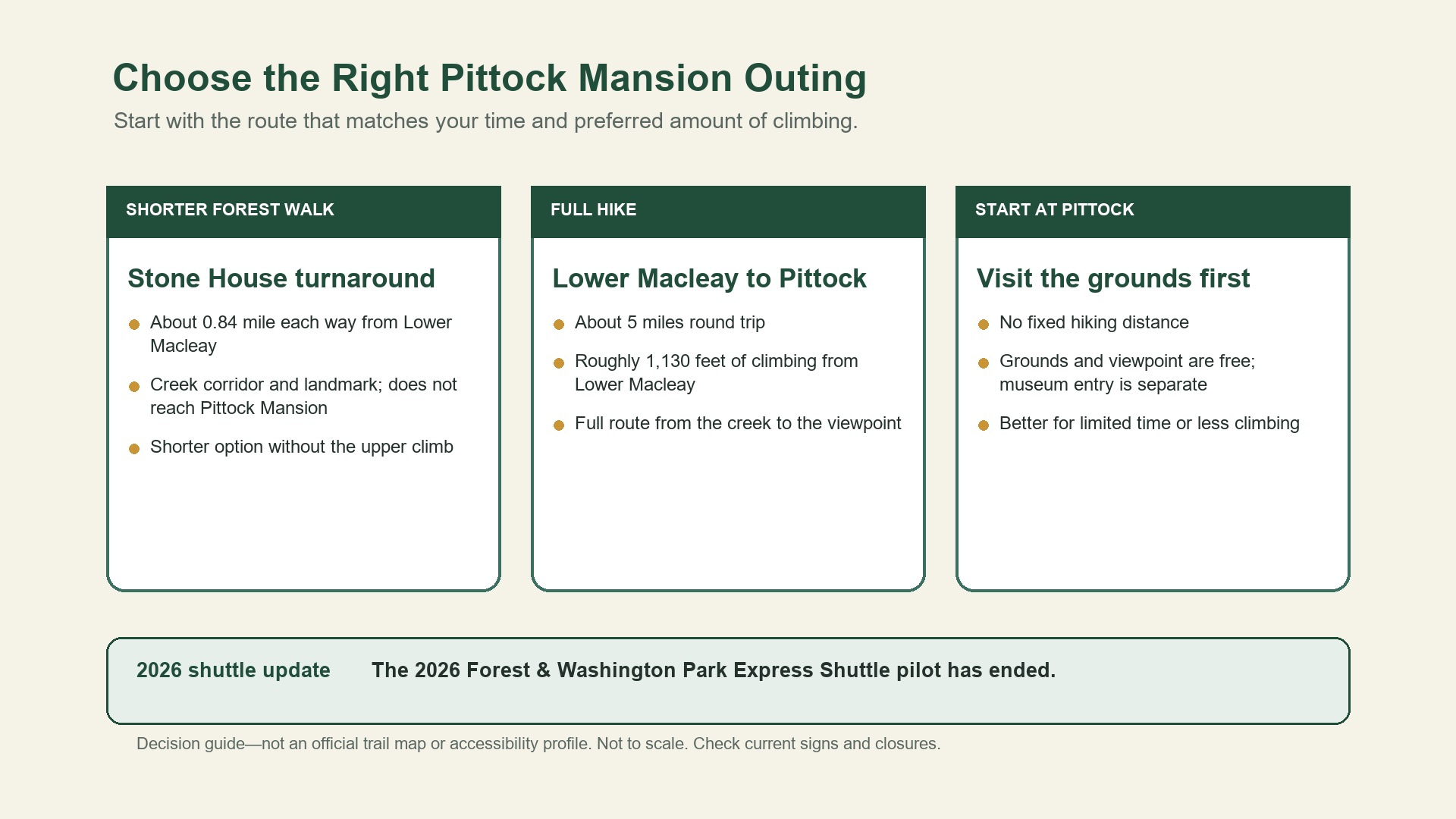
Which Pittock Mansion Route Fits Your Day?
Choose the full Lower Macleay round trip when everyone in the group is comfortable with a sustained climb, uneven natural-surface trail, and about five miles of hiking. This option follows the complete route from the creek corridor to the Pittock viewpoint.
Turn around at the Stone House when your group wants a recognizable Forest Park destination without committing to the upper climb. Portland Parks’ trailhead map places the Lower Macleay–Wildwood junction and Stone House about 0.84 mile from the trailhead, making the out-and-back roughly 1.7 miles. The landmark is commonly called Witch’s Castle, but it is not Pittock Mansion and does not complete the full route described in this guide.
Start at Pittock Mansion when the viewpoint and grounds matter more than trail mileage. The park grounds and viewpoint are free; museum admission and operating hours are separate. You can pair a visit to the grounds with a short walk, but it is not the Lower Macleay hike unless you descend to the trail and climb back.
Pittock Mansion Hike at a Glance
| Trip detail | Planning information |
|---|---|
| Primary start | Lower Macleay Trailhead, 2960 NW Upshur Street |
| Full route | Lower Macleay Trail → Wildwood Trail → Pittock Mansion |
| Full distance | Approximately 2.5 miles one way or 5 miles round trip |
| Elevation gain from Lower Macleay | Approximately 1,130 feet |
| Stone House option | About 0.84 mile one way from Lower Macleay |
| Surface | Initial pavement, then packed dirt, roots, rocks, steep grades, and short paved-road sections |
| Road crossing | NW Cornell at the signed crossing |
| Lower Macleay amenities | Restrooms, water fountain, pavilion, picnic tables, and bicycle parking |
| Pittock grounds | Free; museum admission and hours are separate |
| Dogs | Leash required at Pittock Mansion park; follow all posted rules along the route |
| Current shuttle | The 2026 Express Shuttle pilot has ended |
The distance and elevation figures above are Portland Parks estimates published with the 2026 shuttle project. They are useful for comparing route options, but small detours around the grounds can change the total recorded by a GPS device.
From Balch Creek to the Stone House
The Lower Macleay route begins with its gentlest and most accessible section. Portland Parks describes a paved segment leaving the trailhead, with picnic facilities, restrooms, a water fountain, and bicycle parking nearby. The paved route follows Balch Creek before narrowing and eventually changing to packed dirt.
That surface change matters. Beyond the paved turnaround, the official profile notes roots, cobbles, exposed culverts, abrupt edges, and grades reaching roughly 16–20 percent in places. The entire route to Pittock Mansion should not be described as accessible simply because the opening segment is paved.
The creek corridor leads to the Stone House at the Wildwood Trail junction. The ruins make a natural turnaround for the shorter hike. Continue on Wildwood only if your group still has enough time and is comfortable with the remaining climb, weather, and trail conditions.
The Climb from the Stone House to Pittock Mansion
South of the Stone House, the route becomes steeper and more strenuous. The creekside approach gives way to a longer uphill segment with switchbacks and uneven natural surfaces. Portland Parks estimates the route from Pittock Mansion to Lower Macleay at approximately 2.5 miles one way with 1,130 feet of elevation loss; hiking in the opposite direction turns that descent into a sustained climb.
The viewpoint is the natural finish for the hike, but trail access and museum admission are separate. Reaching the grounds does not include museum admission. Check the official Pittock Mansion page if you plan to enter the building, and allow enough time to return to Lower Macleay before dark.
Crossing NW Cornell Safely
The route crosses NW Cornell once. Portland Parks identifies a marked crosswalk on the Lower Macleay–Pittock connection. Cross there and follow current signs rather than taking an unmarked shortcut across the road.
The road crossing is also a good place to reassess the hike. Wet roots, slick leaves, fatigue, traffic, and fading light can make the return harder than the mileage suggests. If your group is already moving slowly before the upper climb, turning around is a sensible choice—not a failed hike.
Parking at Lower Macleay and Pittock Mansion
Lower Macleay’s detailed trail profile shows three ADA stalls and three general stalls in the trailhead roundabout. Nearby lawful street parking may be available, but it is shared with residents and never guaranteed. Follow posted restrictions, keep driveways clear, and remove visible valuables from the vehicle.
Pittock Mansion’s main lot remains pay-to-park under Portland Parks’ general parking guide. The park page still displays a summer notice about five paid hiker spaces and free gravel pullouts along Pittock Drive, but that notice applied only from July 2 through September 7, 2026. Do not assume those arrangements still apply to a later visit. Check the current park notice and posted signs before choosing where to park; this guide cannot guarantee a space.
Parking at Pittock is most practical for a visit focused on the mansion grounds or for a carefully arranged one-way hike. If your group descends toward Lower Macleay and returns on foot, you still need to account for the climb back to the car.
Transit to Lower Macleay and the End of the 2026 Shuttle
Portland Parks identifies TriMet lines 15, 26, and 77 as serving access near Lower Macleay. Bus routes and schedules can change, so use the current TriMet Trip Planner rather than treating those line numbers as a departure-day timetable.
Do not plan a one-way hike around the Forest & Washington Park Express Shuttle. That free pilot operated on Fridays and Saturdays from June 12 through August 22, 2026, and Portland Parks now states that it has ended. A future service announcement would require a fresh check before this page could recommend a shuttle-assisted itinerary.
Mud, High Water, and Other Conditions to Check
Frequent rain keeps Forest Park green, but it also changes trail conditions. Rain and high water can produce slick roots, soft tread, standing mud, flooding, downed trees, and small landslides. Portland Parks notes that trail failures can occur and may take time to address.
The creek is scenery, not an invitation to use informal bank paths. The Lower Macleay profile specifically discourages user-created paths to Balch Creek because they damage stream banks and habitat. Stay on the maintained route and keep dogs leashed where required.
Summer brings heat on the upper climb, limited shade near the viewpoint, and heavier activity around the mansion. Carry water beyond what the trailhead fountain provides, because an amenity at the start does not guarantee water along the route. In every season, a static guide cannot report current mud, water level, air quality, visibility, or parking occupancy.

When a Shorter Forest Park Walk Makes More Sense
The Stone House is the clearest shorter alternative because it uses the same Lower Macleay trailhead without requiring the full climb. Starting at Pittock Mansion works better when the view matters more than trail mileage. For options on Leif Erikson Drive, in northern Forest Park, or from other trailheads, use the Forest Park guide instead of trying to make this route work for every group.
Choose a turnaround that leaves enough time and energy for the return. Base that decision on the weather, trail conditions, and the person with the least hiking experience or stamina—not on how close the mansion appears on a map.
Related Guides
- Compare the best hikes in Forest Park
- Compare hikes near Portland
- Choose a shorter Portland-area nature walk
Official Sources
- Portland Parks & Recreation — Forest Park
- Portland Parks & Recreation — Lower Macleay Trail Profile
- Portland Parks & Recreation — Pittock Mansion
- Portland Parks & Recreation — Parking Guide for Parks
- Portland Parks & Recreation — Trail Closures and Delays
- Portland Parks & Recreation — Lower Macleay by Public Transportation
- Portland Parks & Recreation — Forest & Washington Park Express Shuttle
- Portland Parks & Recreation — Forest Park Trails Map
Photo and Graphic Credits
- Balch Creek on Lower Macleay Trail: Gary Halvorson, Oregon State Archives. Source; CC BY 4.0. Edits: reframed from the high-resolution original to a 16:9 landscape format, lightly sharpened, and compressed.
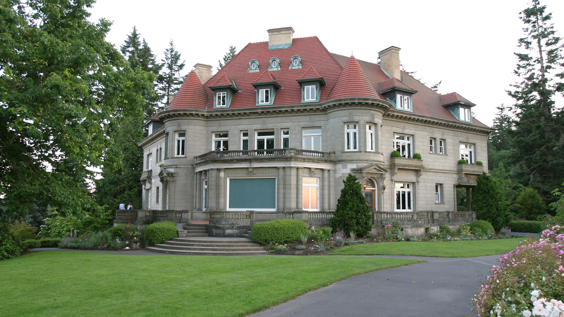
- Pittock Mansion: Cacophony. Source; CC BY-SA 2.5. Edits: reframed from the high-resolution original to a 16:9 landscape format, lightly sharpened, and compressed.
- Portland and Mount Hood from Pittock Mansion: Gary Halvorson, Oregon State Archives. Source; CC BY 4.0. Edits: reframed from the high-resolution original to a 16:9 landscape format, lightly sharpened, and compressed.
- Outing-choice graphic: Editorial team. Original synthesis based on the cited Portland Parks records; proportionally reformatted on a 16:9 landscape canvas without removing content; not an official map or accessibility profile; not to scale.