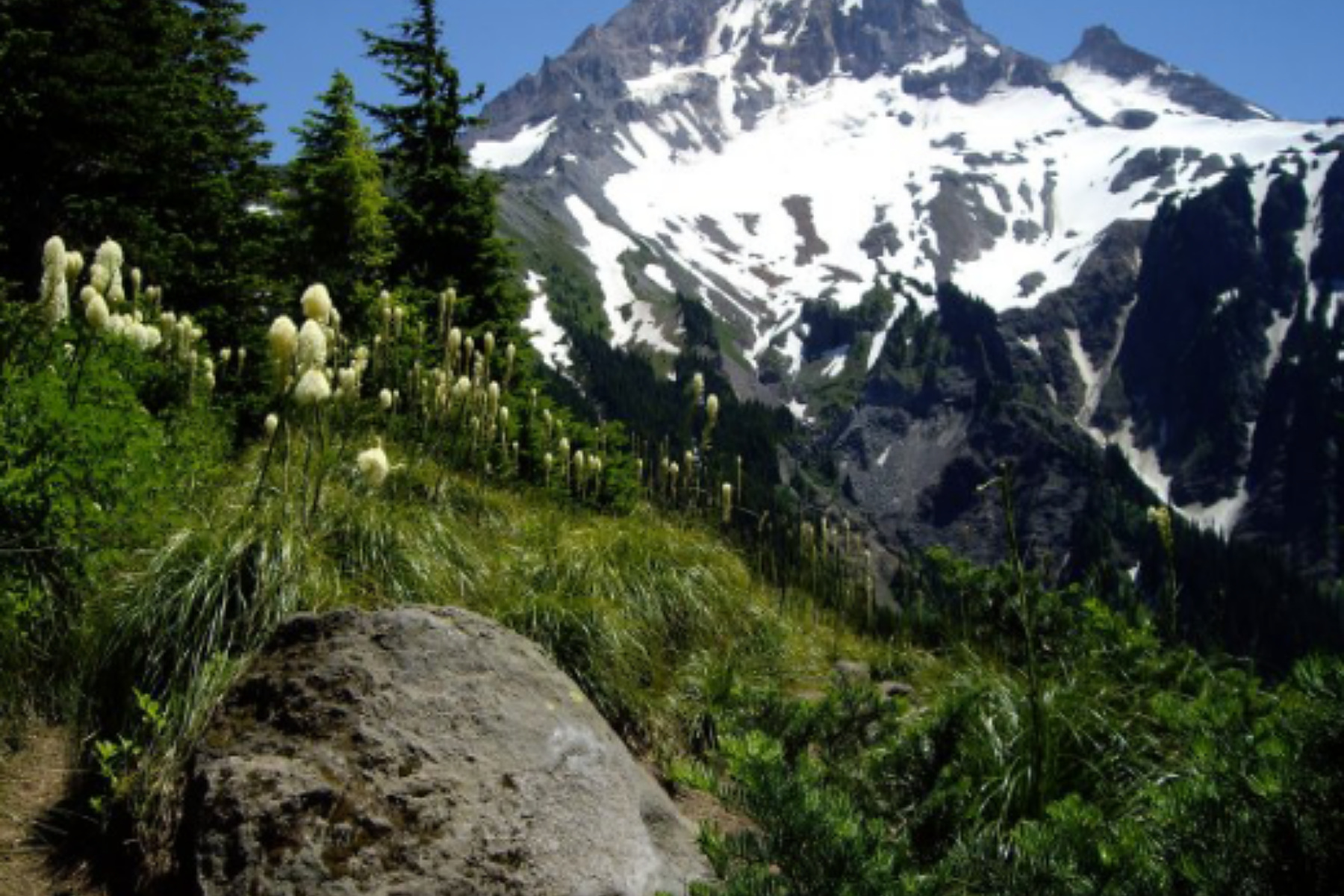
McNeil Point is a demanding Mount Hood day hike commonly approached from Top Spur Trailhead. The official Top Spur Trail is only 0.5 mile one way; it is the first leg of the hike, not the entire route. A commonly used non-official estimate puts the full round trip at about 10.4 miles with roughly 2,200 feet of elevation gain, although the exact total depends on the route you follow.
The most important decisions come before you reach the trail. The small parking area, multi-road approach, seasonal snow, route choices beyond Top Spur, parking fee or recreation pass, and separate wilderness permit all affect whether the hike is a realistic choice for your group.
Status checked September 2, 2026. No McNeil Point- or Top Spur-specific closure appeared on the Mt. Hood National Forest alerts page during this check. That is not a guarantee of access. Recheck official alerts, forest-road conditions, weather, snow, smoke, and fire restrictions before leaving. This guide does not provide live conditions.
Is the McNeil Point Hike Right for You?
McNeil Point is a good choice when your group is prepared for a full mountain day, can navigate a connected trail network, and has checked the entire forest-road approach. It is not a quick stop, despite the 0.5-mile distance listed for Top Spur. That figure covers only the first trail segment.
Before choosing this hike, make sure you can:
- allow for about 10.4 miles and 2,200 feet of gain, knowing that the exact route may change the total;
- reach Top Spur Trailhead legally on the current roads and with a vehicle suited to the reported conditions;
- navigate signed junctions with a current map rather than relying only on a phone connection;
- turn around before the shelter if snow, poor visibility, limited time, or uncertainty about the route becomes a concern;
- carry the water needed for the day, because the trailhead has no potable water.
Choose a shorter or simpler hike if the roads are snow-covered or seasonally closed, the small parking area is full, or your group cannot comfortably manage the estimated distance and climbing. Turn around early if the route becomes unclear. Do not rely on an unverified roadside shoulder or private road for overflow parking.
What the Full McNeil Point Hike Requires
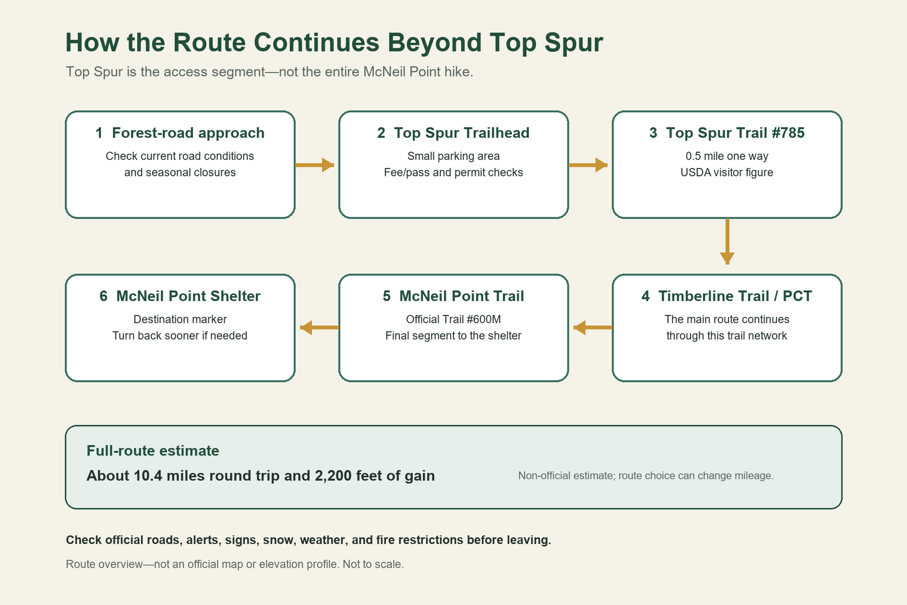
Top Spur Trail #785 rises from about 4,000 to 4,300 feet over its official 0.5-mile length. It connects the trailhead to the Timberline Trail #600 and Pacific Crest Trail #2000 network. The route to McNeil Point then continues through that network before reaching McNeil Point Trail #600M, the final official segment to the shelter.
The Forest Service’s older “Most Difficult” label applies to Top Spur #785; it is not a universal rating for every version of the McNeil Point hike. Assess the full route by its distance, climbing, snow, navigation demands, and the effort required for the return.
McNeil Point Trail at a Glance
| Trip detail | Planning information |
|---|---|
| Common starting point | Top Spur Trailhead |
| Top Spur access segment | 0.5 mile one way; USDA Forest Service visitor figure |
| Estimated full-route distance | About 10.4 miles round trip; non-official planning estimate |
| Estimated full-route elevation gain | About 2,200 feet; non-official planning estimate |
| Main trail network | Top Spur #785 → Timberline Trail #600 / PCT #2000 → McNeil Point #600M |
| Trailhead capacity | About 10 medium vehicles; no space is guaranteed |
| Day-use fee | $5 per vehicle per day, May 1–October 31, as checked September 2, 2026 |
| Wilderness permit | Free, self-issued permit, May 15–October 15, as checked September 2, 2026 |
| Trailhead water | No potable water |
| Managing agency | USDA Forest Service, Mt. Hood National Forest |
The full-route distance and elevation gain come from a non-official Oregon Hikers planning estimate, not a single Forest Service measurement. Do not estimate the full hike by simply doubling the 0.5-mile Top Spur figure.
How the Route Continues Beyond Top Spur
The Forest Service describes Top Spur as a short connector to the Timberline Trail and PCT. Its 0.5-mile figure covers Trail #785 only. McNeil Point is a separate official trail, #600M, from the Timberline Trail to McNeil Point Shelter. The public GIS layer records that segment at about 0.888 mile, but it still excludes the Top Spur connector, intervening network, route choices near Bald Mountain, and return. Use a current map and signs at the junctions.
From Top Spur Trailhead to the Timberline Trail
Begin at the signed Top Spur Trailhead and follow official Trail #785 toward its connections with the Timberline Trail and PCT. Confirm the trail numbers on current signs and on the latest Forest Service material. This short segment leads into the larger trail network; reaching the junction does not mean the day’s climbing or navigation is over.
Continuing Toward McNeil Point Shelter
Stay with the established trail network toward McNeil Point Trail #600M. The Forest Service defines that trail as the connection from the Timberline Trail to McNeil Point Shelter. Treat the shelter as a destination marker, not as a promised emergency facility or guaranteed protection from weather.
The official McNeil Point page notes views toward the Bull Run watershed and mountains to the north. Weather, smoke, and clouds can obscure those views on any given day.
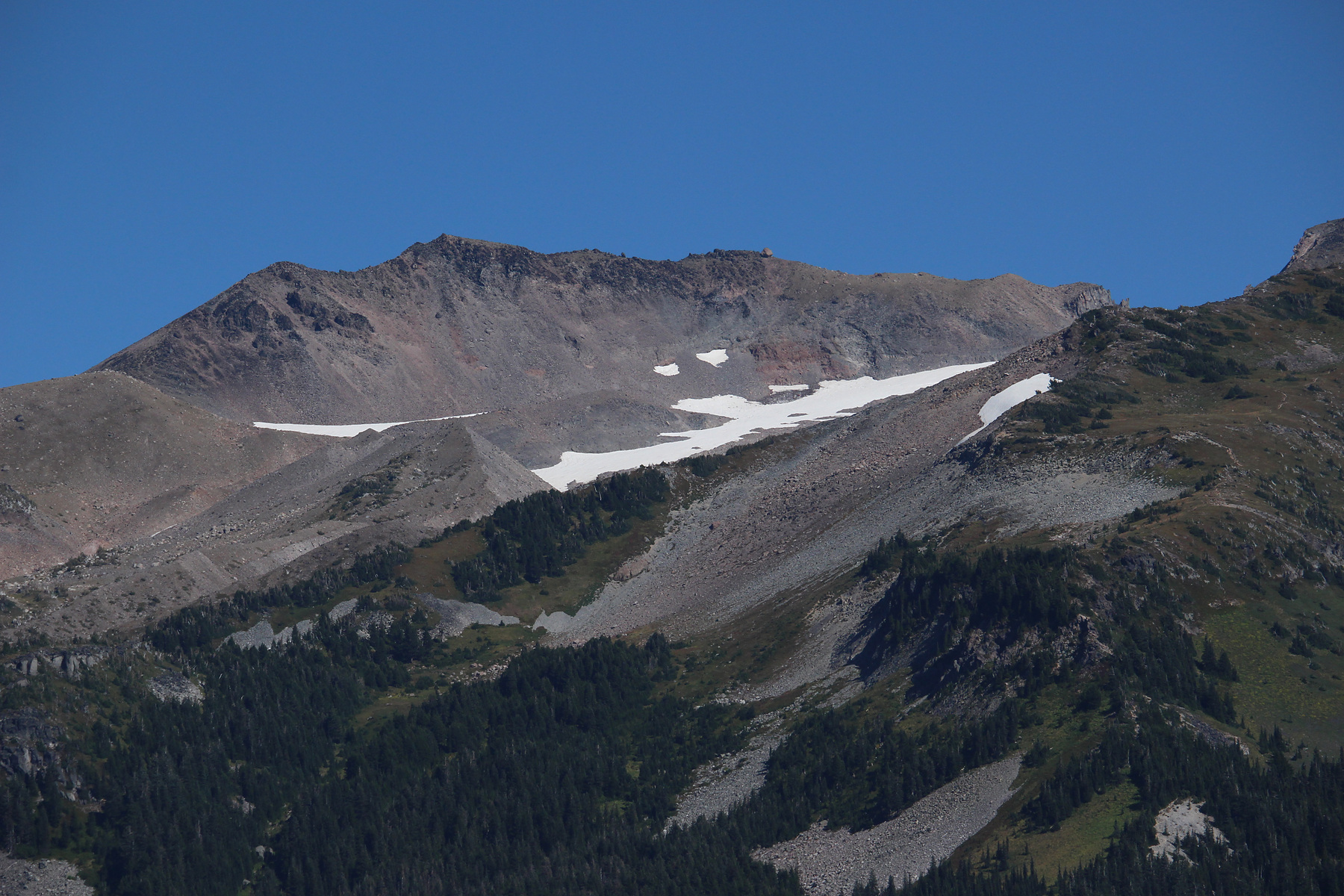
Follow the Main Trail, Not the Steep Shortcut
Some third-party route descriptions show more than one line near Bald Mountain and McNeil Point. One of those variations is a steep informal path. Do not treat it as the normal route, a time-saving recommendation, or an official trail.
Stay with the established Top Spur, Timberline Trail/PCT, and McNeil Point trail system. At an uncertain junction, compare current signs with a reliable map. If snow hides the tread, visibility closes in, or the route no longer agrees with the map, return by the known route. This guide omits the shortcut because it involves steeper footing, more difficult navigation, and greater fall risk.
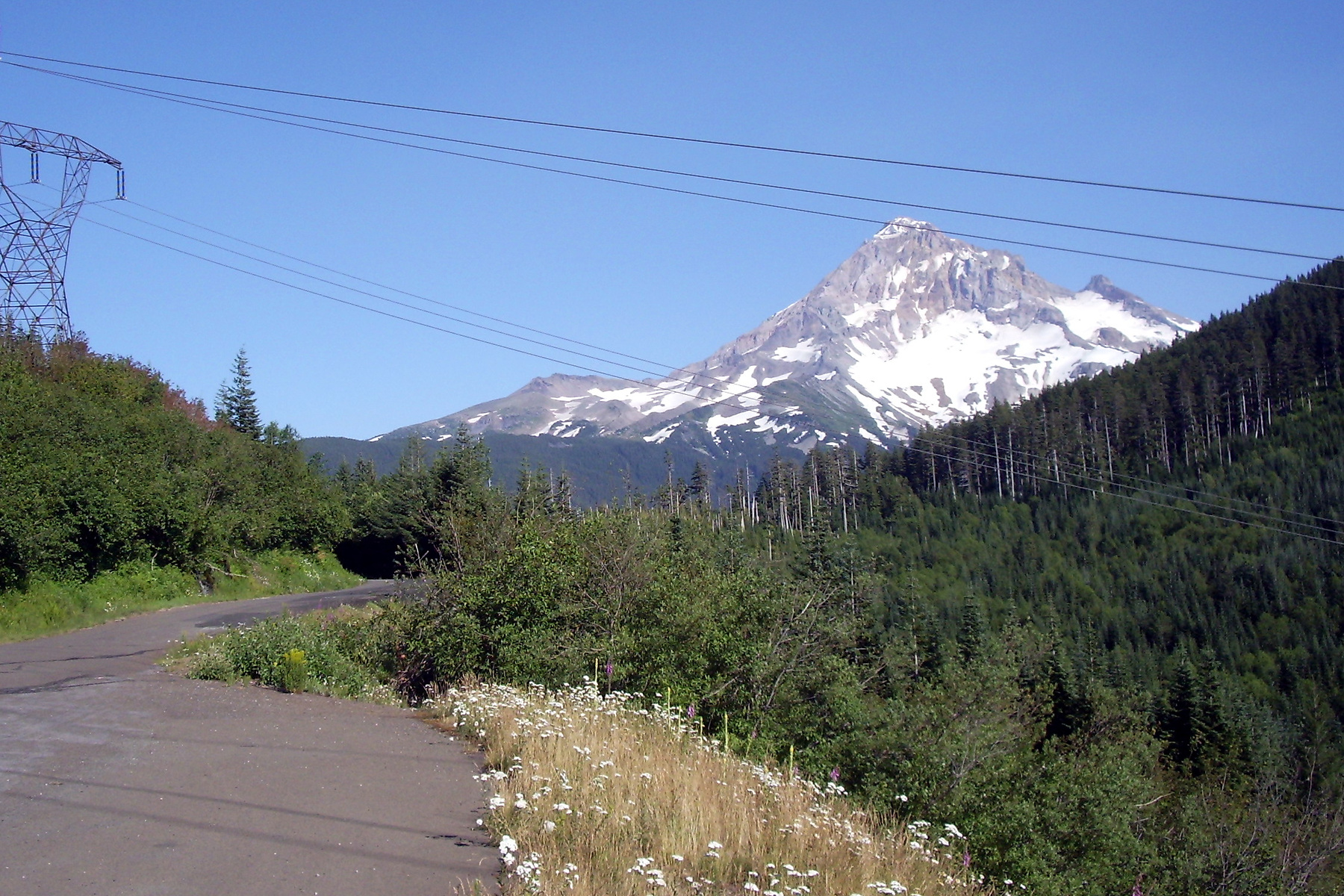
Getting to Top Spur Trailhead
Road access is a central part of planning this hike. The Forest Service’s current directions use East Lolo Pass Road/Forest Road 18, then Forest Roads 1825 and 1828, followed by gravel spur FR 1828-118. Use the official Top Spur Trailhead page for the latest directions and the listed coordinates, 45.4077, -121.785938.
Check the Entire Forest Road Approach
FR 1825 has a posted seasonal closure at mile 0.7 from December 1 through April 1. FR 1828 is typically impassable in winter, and FR 1828-118 can remain impassable into April or May. These roads are not maintained in winter. Under winter conditions, the Forest Service recommends a high-clearance four-wheel-drive vehicle, winter equipment, and chains; that is a seasonal recommendation, not a statement that four-wheel drive is legally required year-round.
The official road table is not complete and can lag conditions on the ground. The Forest Service also warns that online routing north of Lolo Pass can lead toward a private road. Save the official directions before losing service and do not improvise through private property.
Parking and Trailhead Facilities
Top Spur Trailhead has space for about 10 medium vehicles. Paying a fee or holding a pass does not reserve a space, and this guide cannot confirm legal overflow parking. If the lot is full, use a previously verified alternative hike rather than blocking traffic, parking on vegetation, or leaving a vehicle on an unconfirmed shoulder.
The Forest Service lists a toilet, picnic table, interpretive sign, and garbage can, with maintenance generally scheduled from May 1 through October 31. The trailhead has no potable water. Seasonal servicing can change, so recheck the facility details before publication and before the hike.
Parking Fees, Passes, and Wilderness Permits
Three different requirements are easy to combine by mistake:
- Day-use fee: The trailhead listed $5 per vehicle per day from May 1 through October 31 when checked September 2, 2026.
- Recreation pass: An accepted recreation pass can serve as payment at this fee site. Check the current Mt. Hood passes page for accepted passes and purchase options.
- Wilderness permit: A free, self-issued wilderness permit is required from May 15 through October 15 under the current trailhead guidance. Obtain it at the trailhead and carry it as directed.
The wilderness permit is not a parking reservation, and the parking fee or pass does not replace the permit. Recheck the amounts, accepted passes, and dates on the publication day and again before the trip.
Snow, Fire Restrictions, and Other Conditions
A passable access road does not mean the trail is clear. McNeil Point is high enough for snow to linger, often through June, and deep drifts can remain after lower approaches become passable. The Forest Service advises snowshoes or traction until the route is clear. Traction devices or snowshoes cannot solve the navigation problem when snow hides the tread or signs. Continue only when visibility is adequate and the route remains clear.
The Mt. Hood National Forest fire restriction checked September 2, 2026, prohibited campfires and other open fires forestwide under Order 06-06-00-26-03, then scheduled through October 31 unless rescinded earlier. A fire-use restriction is not the same as a route closure. Check the current alert list for the order that applies on your date.
Smoke, heat, wind, storms, and low clouds can make the route unsuitable after this guide was updated. Use current official weather and fire information; this page cannot report present snow depth, road passability, smoke, visibility, or parking occupancy.
When Another Mount Hood Hike Makes More Sense
Clear skies alone do not make McNeil Point the right choice. If its distance, roads, parking, snow, or navigation demands do not fit, choose another objective around the limiting factor rather than forcing this one.
For another west-side destination, Ramona Falls has its own road-access considerations and a potentially hazardous Sandy River crossing. It is not automatically easier or available, so check that guide’s current status first.
Tom, Dick and Harry Mountain offers another mountain-view hike from the Mirror Lake corridor, with a different starting point and route structure. For a shorter day, compare Mirror Lake or Trillium Lake, while still checking seasonal access and snow.
Related Guides
- Compare Mount Hood hikes by area, season, and effort
- Plan the Tom, Dick and Harry Mountain route
- Review the Sandy River crossing at Ramona Falls
- Choose between Mirror Lake’s summer and winter approaches
- See how Trillium Lake access changes by season
Official Sources
- USDA Forest Service — McNeil Point Trail
- USDA Forest Service — Top Spur Trailhead
- USDA Forest Service — Top Spur Trail #785 PDF
- USDA Forest Service — National Forest Roads
- USDA Forest Service — Mt. Hood National Forest Alerts
- USDA Forest Service — Fire Restrictions in Effect July 1
- USDA Forest Service — Mt. Hood National Forest Passes
- USDA Forest Service — National Forest System Trails public GIS layer
Photo and Graphic Credits
- Mount Hood from the McNeil Point Trail area: U.S. Forest Service — Pacific Northwest Region. Source; public domain as a U.S. federal government work. Edits: reframed to 3:2, lightly sharpened, and converted to JPEG.
- Barrett Spur and McNeil Point context: Walter Siegmund. Source; CC BY-SA 4.0. Edits: reframed to 3:2, lightly sharpened, and compressed.
- Lolo Pass and Mount Hood: EncMstr. Source; CC BY-SA 3.0. Edits: reframed to 3:2, lightly sharpened, and compressed.
- Route-relationship graphic: Editorial team. Original graphic based on the cited Forest Service records and reformatted to 3:2 without removing content. Not an official map, GPS track, or elevation profile; not to scale.